Digital history projects in progress. Updates posted here.
Enslaved by the Church, Sold for the Republic
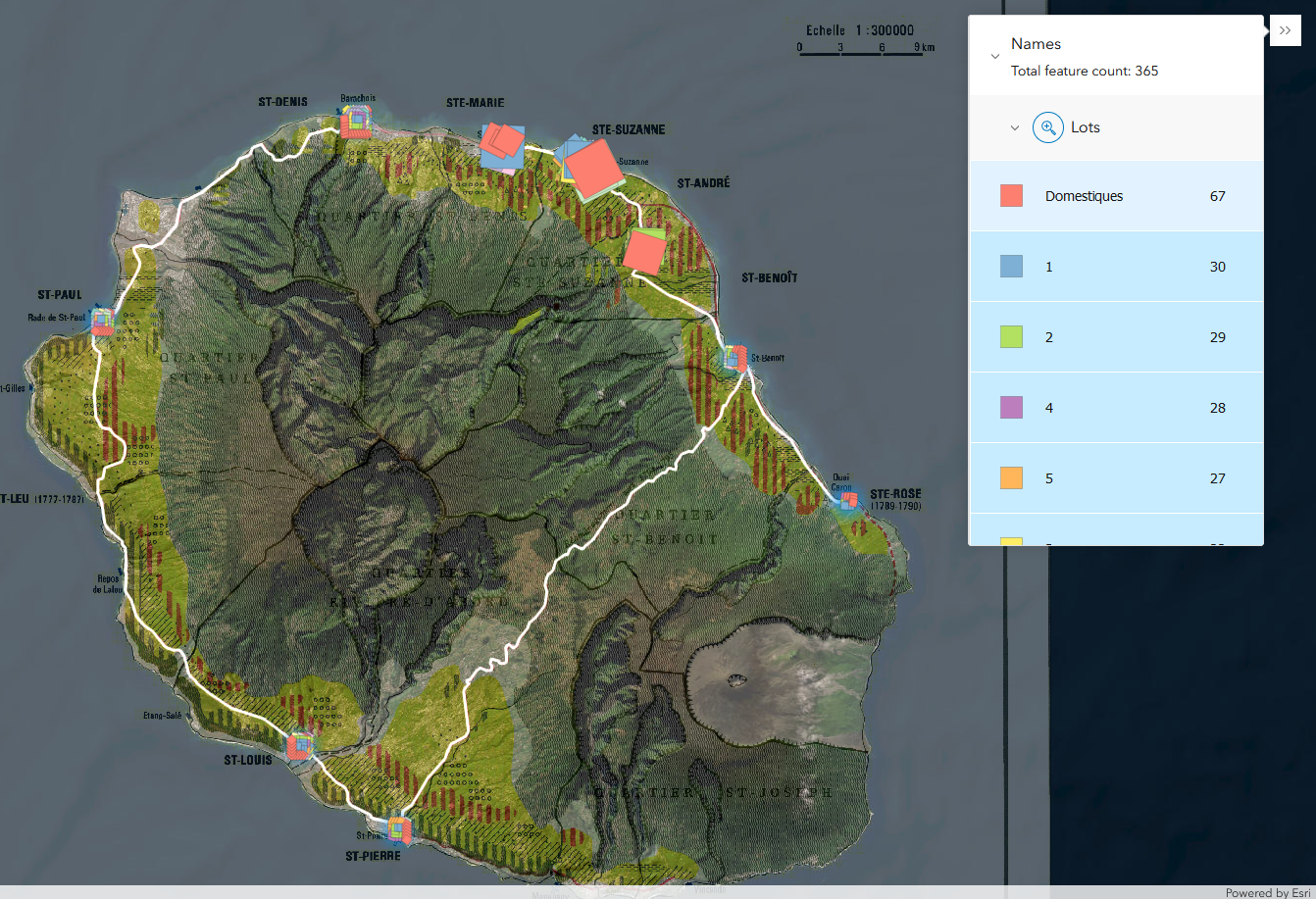
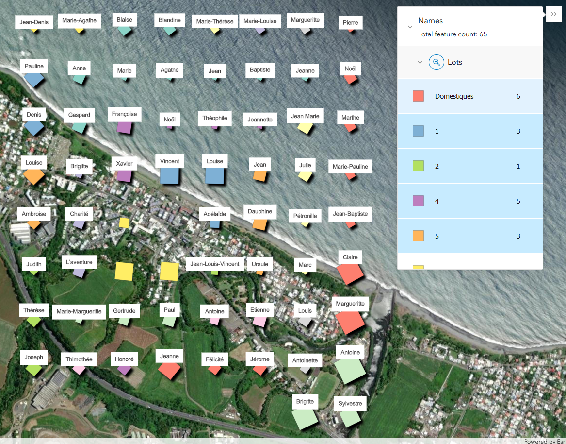
When French revolutionaries seized the assets of the Catholic Church as "national property," the thousands of men, women, and children enslaved by missionary organizations across the colonial empire were not spared. This digital narrative traces their stories of survival and resistance through a close reading of the documents drawn up to facilitate their re-enslavement. It features a first-of-its-kind interactive atlas that maps all sites of slaveholding by Roman Catholic orders and congregations in the French colonial world and beyond.
Explore:
Arkansas Créole: Recovering a Lost Vernacular Landscape
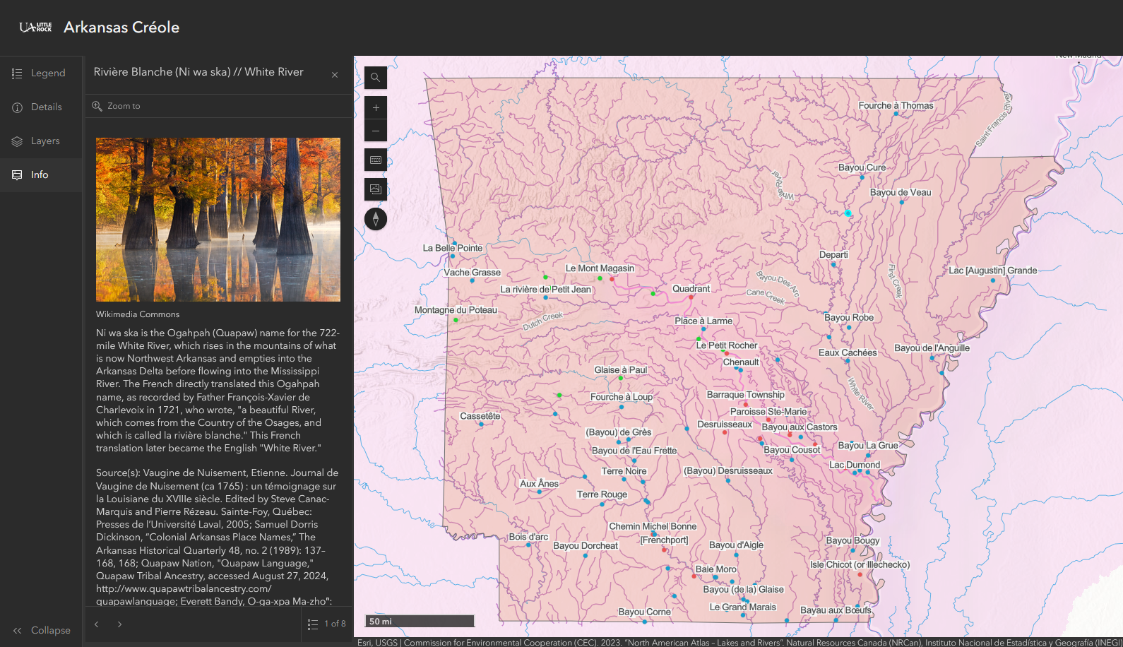
Map App Companion to Arkansas Créole. Click the points on the map to reveal the stories behind the place names.
- Layers: Toggle layers via the "Layers" button.
- Info: Click map points for information pop-ups on the left.
- Search: Search the database of historic names, or locate contemporary geographical features using the search function.
The “French period” of Arkansas history has long been romanticized, whitewashed, or altogether dismissed as inconsequential. This digital history project shines light on the contributions to Arkansas’s culture and geography made by French-speaking people of European, Indigenous, and African descent who lived alongside the Ogahpah Nation under French, Spanish, and early U.S. rule. The accompanying map seeks to recover the stories of the people behind the names of many of the state's settlements, mountains, bayous, and streams.
Explore:
This Unalterable Friendship: New England Merchants in the French Indian Ocean Islands
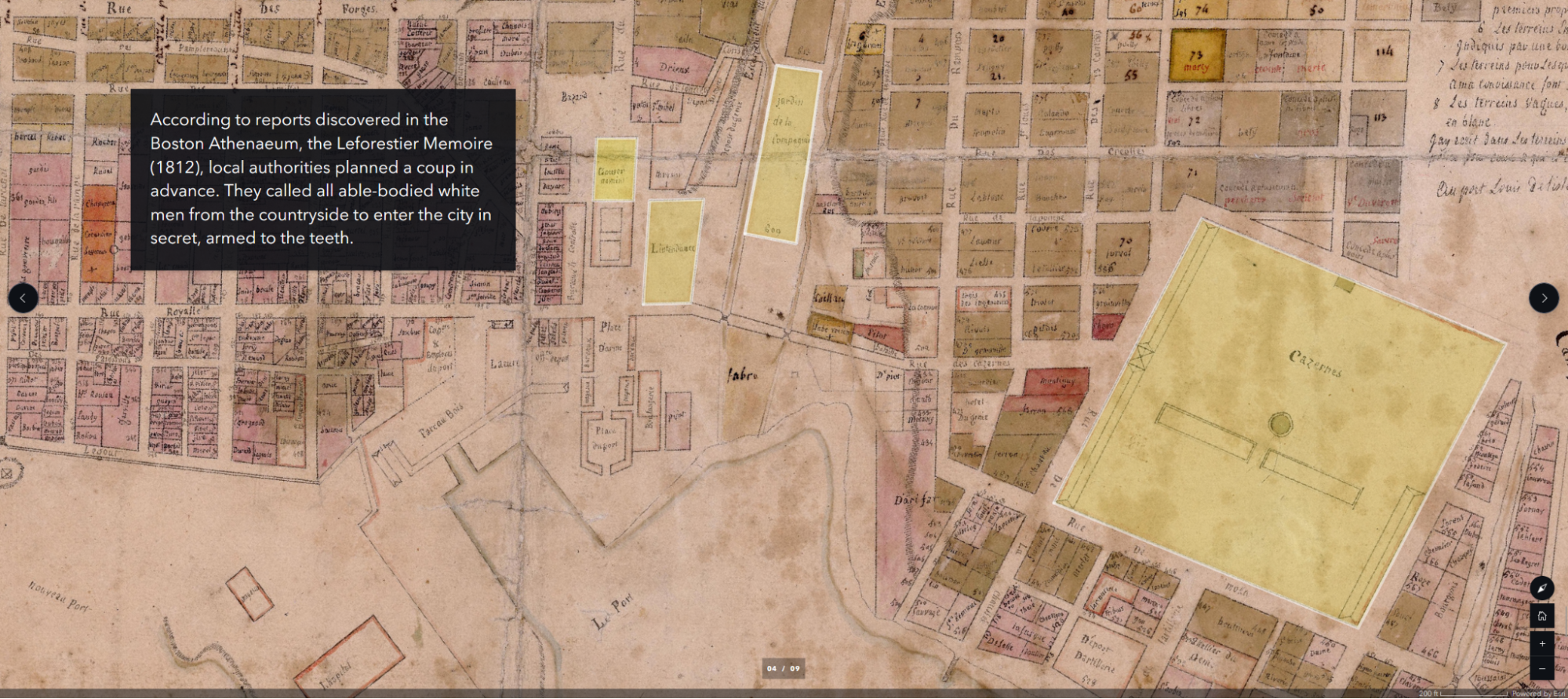
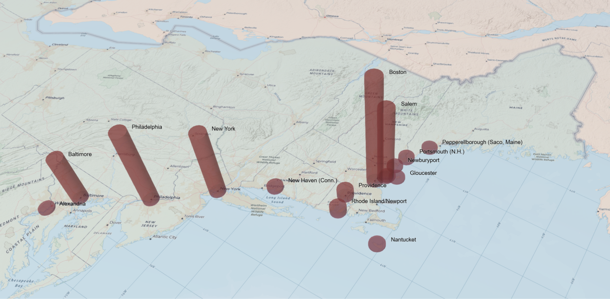
Between 1786 and 1810, Boston was the leading point of origin for ships calling at Port Louis, Mauritius; this map-based overview explores why this distant French island port attracted so many Yankee captains—showing how the French free trade zone, the establishment of a U.S. consulate in 1794, a desire to bypass British markets, and a shared interest in preserving slavery in the Indian Ocean solidified a transoceanic connection between American merchants and Mascarene planters, and how, in the wake of the Haitian Revolution and France’s 1794 Abolition Decree, those same merchants supported a 1796 coup that expelled French commissioners enforcing emancipation (research supported by a Boston Athenæum Library Fellowship from ASECS).
Explore:
Creoles Far From Our Native Place: Mapping the Global Peregrinations of Jean-Baptiste Tabardin
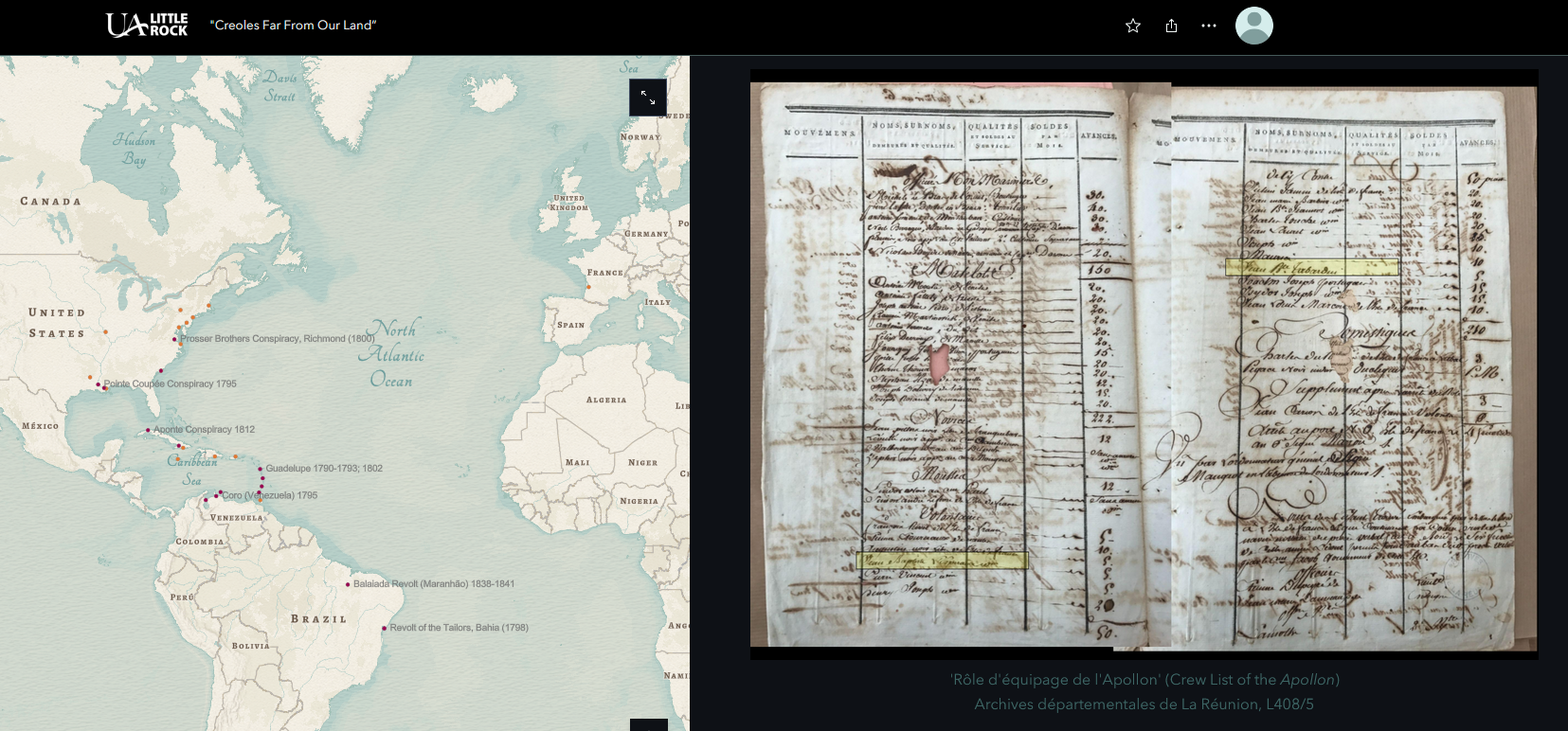
Jean-Baptiste Tabardin, born to an enslaved mother in Mauritius, left behind a remarkable illustrated manuscript chronicling his voyages across the Indian and Atlantic Oceans during the French Revolutionary Wars. Today, "The Life and Adventures of J. B. Tabardin" (c. 1811) is preserved in the manuscript collections of Mauritius’s Carnegie Library. After twelve youthful years as a tailor, steward, and privateer turned prisoner of war, Tabardin reflected on love and masculinity, war and politics, race and religion, and the meaning of life itself.
</p>
Explore:

Back to Top